This post contains some affiliate links. As an Amazon Associate, if you purchase through my links, I earn from qualifying purchases. I might receive a small commission, at no additional cost to you. Thanks for your support!
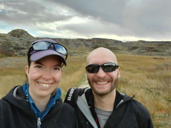
I love going to Drumheller! It’s nice to check out the Royal Tyrell Museum, filled with dinosaur bones and investigate various exhibits. We like to hike in the region every few years. It’s a unique place to discover diverse landscapes, including hoodoos and canyons. With so many hiking options to pick from, I’ve narrowed it down to four spectacular Drumheller hikes for you to explore with your partner.
Table of Contents
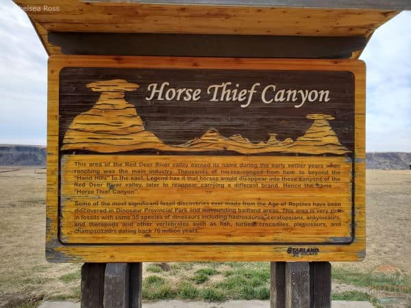
1. Horse Thief Canyon
Location: There are two ways of getting to Horse Thief Canyon from downtown Drumheller. First, go north on Highway 575 and turn right on Highway 837 towards Bleriot Ferry. Cross the Red Deer River on a small, seven-minute free ferry and then make your way south to Horse Thief Canyon. If you prefer a more direct route, drive 18 km northwest from Drumheller city center on Dinosaur Trail (Highway 838), past the Royal Tyrrell Museum, to reach this destination.
Parking: The free parking lot is large enough to accommodate cars and trailers.
Washrooms: Unfortunately, there are no outhouses here.
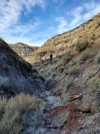
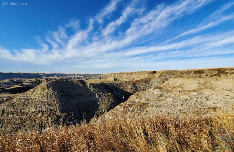
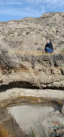
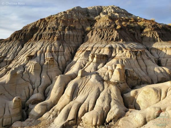
Horse Thief Canyon is a sedimentary basin canyon with dry soil and plants such as tumbleweeds. It is a very unique area to hike where visitors are not restricted to a particular trail; many directions are possible.
Explore Drumheller Hikes
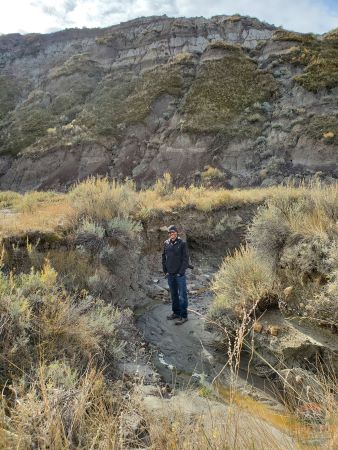
Many dried-up creeks offer more areas to explore than the trails. If you do find creeks with water, these are cool spots to check out. Kris spent a lot of time checking out the creek beds to see what he could find. He never found fossils, but he liked the idea of potentially discovering something.
No Official Trail
As there is no official trail, your exit point might not be entirely obvious if you hike a long distance. We didn’t want to retrace our steps, so we looped around and exited at a different location. It was a bit tricky to get back to our vehicle. We had to go up and down a few hills to regain a visual of our vehicle. If you’re up for an adventure, you’ll definitely find it!
Tip #1: Keep in mind that it could be more difficult to get back to your vehicle than initially expected if you plan to do a loop.
Tip #2: If you take a steep slope up or down, it may be slippery due to loose gravel. Wear hiking shoes with a good grip to avoid falling.
It’s a neat place to experience, likely unlike anything you’ve seen before. Children will love exploring a new landscape with the freedom to choose their own directions in the canyon.
Tip #3: Make sure you can see your children as they choose their own path, so they don’t get lost.
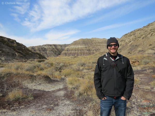
2. Atlas Coal Mine
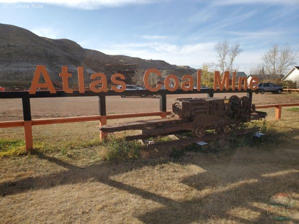
Location: Drive 23 km southeast from Drumheller on Highway 56 and turn right to stay on Highway 10 East. Atlas Coal Mine National Historic Site is located at 110 Century Dr. W, East Coulee, AB T0J 1B0. This destination is on the right side of the road, approximately a 20-minute drive from Drumheller.
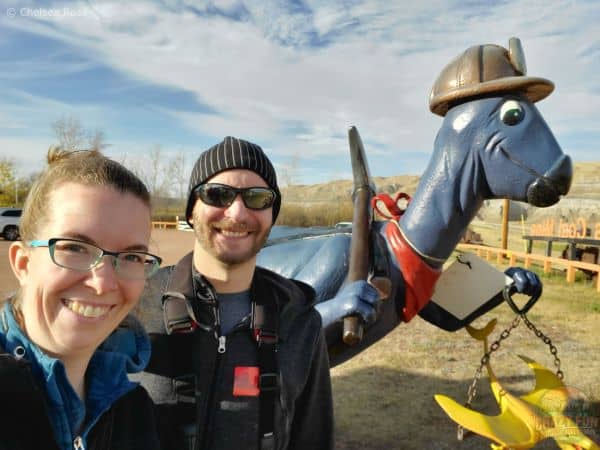
Parking: There are plenty of free parking spaces, as you can see behind us. You can take a picture with the blue dinosaur near the parking lot.
Washrooms: There are washrooms available in one of the buildings near the parking lot.
Price: General admission is $16.95 for adults. The price is worth it for one or two hours of visiting.
Self-Guided Tours
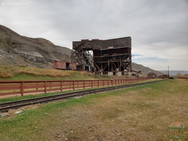
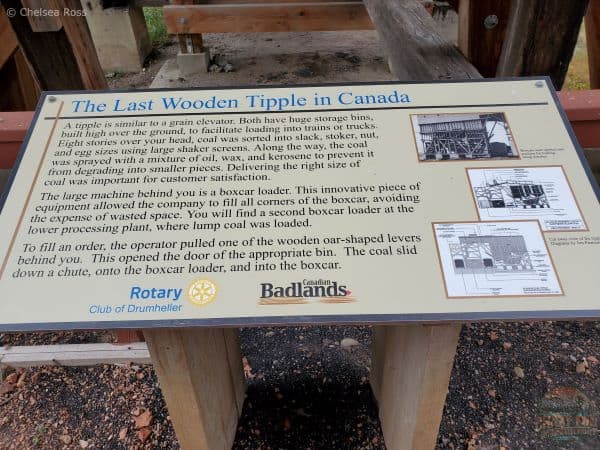
The Atlas Coal Mine is a neat place for a light hike. It offers self-guided tours to explore the property of an old mine that operated from 1936 to 1979. It describes the lives of coal miners and their work at the last wooden tipple in Canada. The structure was eight stories high and facilitated loading coal into trains and trucks for delivery away from the mine.
Tip: You might need to treat a sunburn if you stay in the sun for too long. Make sure to apply sunscreen before hiking in the fields on a beautiful sunny day.
Mine Layout
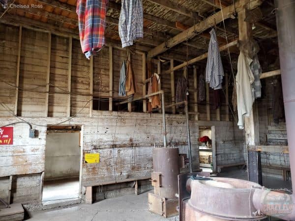
This is the men’s changing room, offering no privacy for a shower back in those days. They hung their clean clothes up high with a pulley system while showering. Once they were clean, they brought their garments back down to wear home after their shift.
Old Machinery
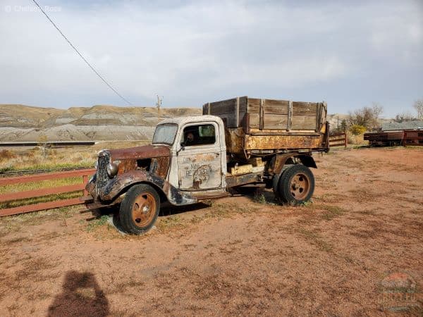
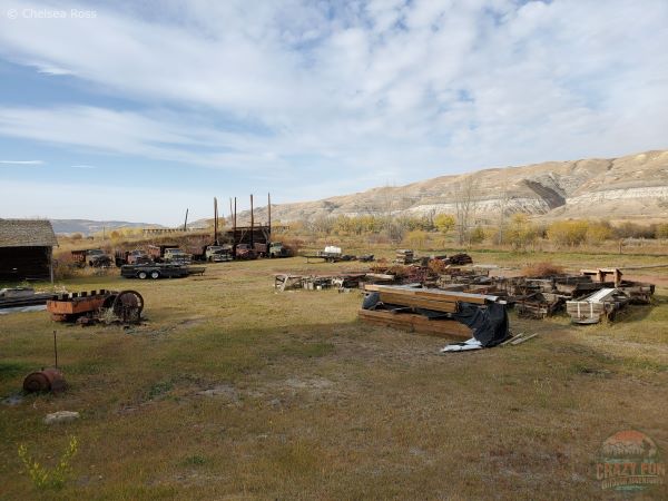
Many different tools, rail cars, and trucks can be seen in the fields nearby. There are also many pieces of mining machinery throughout the property.
Booked Drumheller Hikes
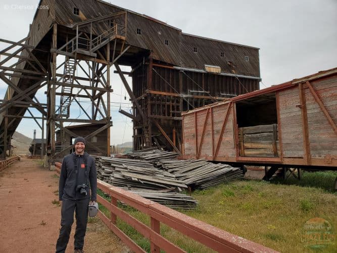
For an additional fee, you have three booking tour options. They offer a train ride (25 minutes), a processing plant tour (45 minutes), and a mine portal hike (1 hour and 15 minutes). Check out the prices here. Book the tours beforehand if you don’t want to miss out, as we did!
Tip: Wear sturdy footwear when exploring this area, especially on tours, for the best possible experience.
3. The Hoodoo Trail
Location: It’s a seven-minute drive northwest of the Atlas Coal Mine National Historic Site and fifteen minutes southeast of Drumheller on Highway 10 East.
Parking: There is enough free parking for small trailers and vehicles. If you go in the summer, the parking lot might fill up quickly.
Washrooms: There are outhouses in the parking lot for your convenience.
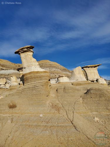
The Hoodoo trail is a shorter hike, but a great opportunity to see hoodoos! It starts near the parking lot and features stairs leading to the mid-section of the Hoodoos. Once you’ve reached halfway, you’ll need to follow a path to the top, allowing hikers to explore.
Tip #1: The soft rock can be slippery even when dry; rely on your gripped shoes to get you up the rest of the way. It’s especially slippery when wet; be cautious!
Picturesque Hill Top
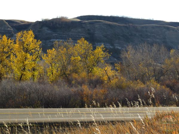
Once you’ve reached the top, enjoy looking at the beautiful scenery. If you go in the fall, the changing colours of the leaves from green to yellow make for gorgeous pictures.
To return to your vehicle, head down the opposite side of the hill and explore that area on your way back.
Tip #2: The top of the hill might merge into a narrow downward path. Be careful on the steep sections.
You’ll likely reach a road at the bottom that loops back to your vehicle. You can look back at the fun you had climbing up the trail and remember the beautiful views that surrounded you at the top.
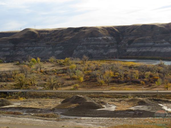
4. The Badlands Interpretive Trail
Location: The Badlands Interpretive Trail is located in Midland Provincial Park. The hike leaves the Royal Tyrell Museum and heads east to loop back to your parked vehicle.
Parking: Park in the Royal Tyrell Museum parking lot (plenty of free parking for cars and trailers).
Washrooms: There are washrooms in the Royal Tyrell Museum and an outhouse at McMullen Island Day Use Area along the way.
Paved Drumheller Hikes
The Badlands Interpretive Trail starts as a paved trail through the hoodoo formations in the area. Wheelchair users can join for a walk, but keep in mind that the trail is bumpy with many ups and downs as soon as you leave the museum. Families can walk side by side on this wide trail. There are lots of different rock formations to look at while walking.
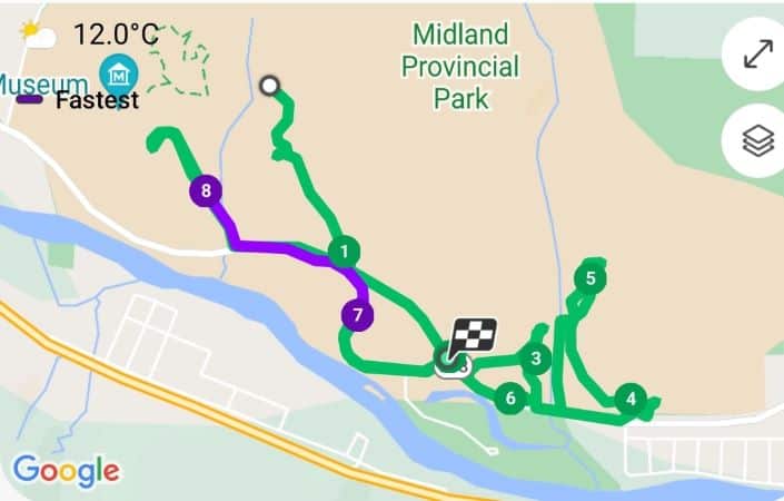
Day-Use Area
This picture was taken on the opposite side of the McMullen Island Day Use Area, near number seven on the map above. You can find an outhouse there. It’s a gorgeous walk near the Red Deer River. The path until this point is nice and wide.
Newcastle Mine
This picture shows what the north side looks like, near number three on the map. We found Newcastle Mine. There wasn’t much to see at this location.
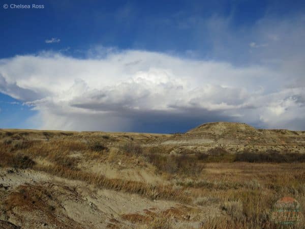
Tip: If storm clouds start forming, remember the distance back to your initial starting point. We had brought water and snacks, but had forgotten our rain gear. If it had started pouring, we would have been very wet and potentially cold. We anticipated getting rained on, but thankfully it missed us. If it does rain, here are some tips to stay positive while hiking in the rain.
Midland Coal Mine
We found an old miner’s cabin at number four. This was the start of the Midland Mine. The rain clouds spared us, allowing us to continue exploring north until number five on the map. We didn’t take pictures of the area since there wasn’t much to see, but we took a selfie instead. Most of the mine was underground with only a few scraps left on the ground. We found an old gazebo. We weren’t sure whether that was part of the old mine or had been built there randomly.
A few descriptions were available to tell us what the site previously looked like, but it was hard to imagine with barely anything left. Regardless of the state of the mine, it was nice to see more of the area’s landscapes, go for a walk, and enjoy each other’s company.
Tip: Once we left the day-use area and reached the north side of the road, we hiked along the road since there was no longer a trail. Keep in mind that the mines are better accessed by a car.
Journey Back to Our Vehicle
We headed back to the North Dinosaur Trail since it was getting dark. Kris and I walked back to the day-use area, passing number seven and took the paved trail until we reached the road. Not wanting to take the longer loop on the paved trails, we decided to take the road back, which was quicker to reach our vehicle. We watched for vehicles since there wasn’t a path here either.
It made for an interesting day. We had no idea where we’d end up, but it was fun to explore the different areas of Midland Provincial Park.
What to Wear?
These different layers kept us comfortable while hiking.
- 100% Merino Wool – Women’s Midweight Base Layer – Long Sleeve Crew – Burgundy
- Columbia Women’s Powder Lite II Hooded Jacket, Black
- Columbia Women’s Silver Ridge Utility Convertible Pant, Stone Green
- SmartWool Women’s Hike Light Cushion Margarita Crew Socks, Purple Eclipse
- La Sportiva Women’s Nucleo High II GTX Wide Hiking Boots
Where to Stay?
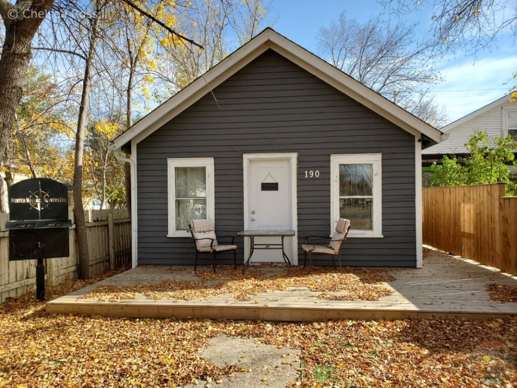
Stay in a vacation home like this one in Drumheller. You’ll have access to a house to cook or eat takeout for supper, and to relax and unwind. It’s a perfect place to stay, to call your home away from home. If you find one located in downtown Drumheller, it’s easily accessible to all the hikes in the area and to the museum.
Final Thoughts
These four Drumheller hikes were so much fun to explore with Kris. There’s always something new to explore, which is why I love spending time in the outdoors. There are always new places to see and discover. We didn’t see a mine, but had a fantastic day on our Badlands interpretive trail outing. The Atlas Coal Mine had so many neat things to learn about as we walked around the property. The Hoodoo trail, although short, is so cool to see for yourself and take pictures. Last but not least, Horse Thief Canyon offers various directions to explore a new landscape. These Drumheller hikes offer so many awesome photo opportunities to help you cherish special memories. Don’t forget your clothing for an awesome time hiking. Stay at a cozy vacation home while visiting to unwind at your leisure. Go have an amazing time! For more fun day trips, go check out places near Edmonton.
Additional Links
- Unique Camping in Alberta
- Nice Weekend Getaway Near Me
- 4 Best Larch Hikes
- Gorgeous Hiking to Laughing Falls
- Athabasca Glacier Hike: What to Expect?
Trip Resources
- Book your flights with Expedia
- Book your hostel through Hostelworld.com
- Book your hotel with Booking.com or Hotels.com
- Book your vacation rental with Vrbo
- Book your experiences through Viator, Tripadvisor or Manawa
Leave a Reply