This post may contain affiliate links. If you purchase through my links, I might receive a small commission, at no additional cost to you.
The River Valley Trails in Edmonton offer many different paths conveniently located throughout the city. The trails provide a variety of views of the river from the East quadrant in Rundle Park to the West quadrant in Terwillegar Park. MacKinnon Ravine Park, Kinsmen Park and Mill Creek Ravine North are all located south of downtown. The trails all link together making it super easy to connect the paths and complete diverse loops. Some loops are long while others can be shorter depending on your preference.
Table of Contents
Gold Bar Park to Rundle Park
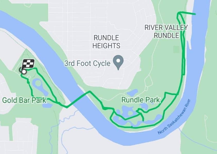
Parking: Gold Bar Park offers a parking lot with plenty of parking stalls. Multiple parking lots are available at Rundle Park if you start there instead.
This path shown in green on the map above was 7.24 kilometres long.
The River Valley Trails in Edmonton from Gold Bar Park to Rundle Park starts at the Gold Bar parking lot or vice versa if you prefer. When driving, it might take you longer to reach one park than the other. Take that into consideration when choosing from which park to start.
There are multiple trails available in Gold Bar Park to walk around. Walking in a northeast direction, you’ll reach a bridge to cross the North Saskatchewan River continuing towards Rundle Park. On the south portion of the trail, you’ll encounter some ponds to walk around. As you can see on the map, it’s possible to return in a different direction and walk around the other side of the ponds.
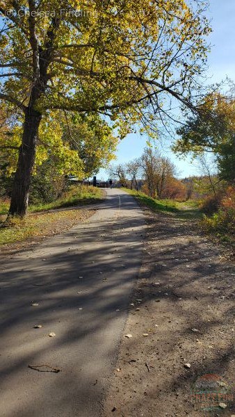
Further north, you’ll continue to walk on paved trails.
Tip: Keep to your side of the trail and listen for bicycle bells in case cyclists want to pass you. Stay on your right side. They should pass on your left.
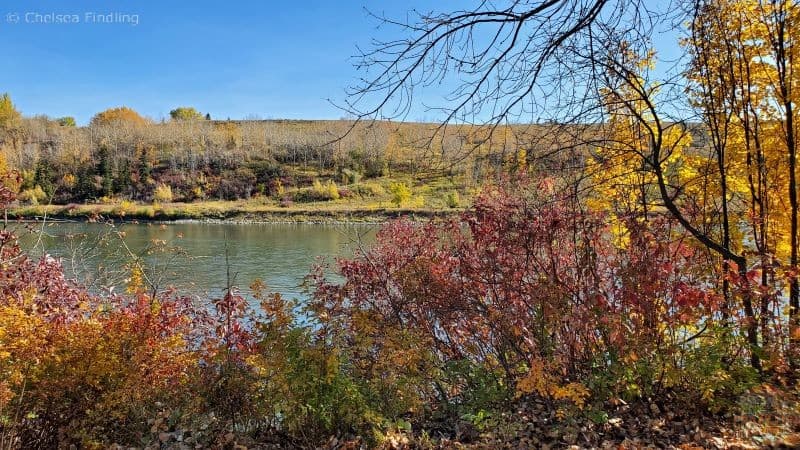
You’ll walk along the river until you reach the Strathcona Science Park Pedestrian Bridge. The bridge’s bench offers the perfect spot to eat your lunch.
Muttart Conservatory
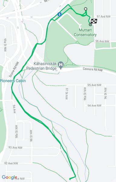
Parking: There is a big parking lot to park your vehicle at the Muttart Conservatory and head out for a walk.
This trail was 3.7 km long.
You’ll cross the tracks at the LRT station and walk parallel to the tracks to make your way towards Mill Creek Ravine North.
The Pyramids
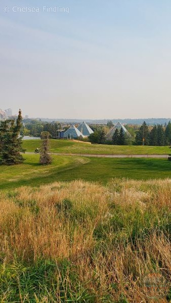
Near the Dove of Peace monument, you can look back to see the pyramids at the Muttart Conservatory.
Kâhasinîskâk Pedestrian Bridge
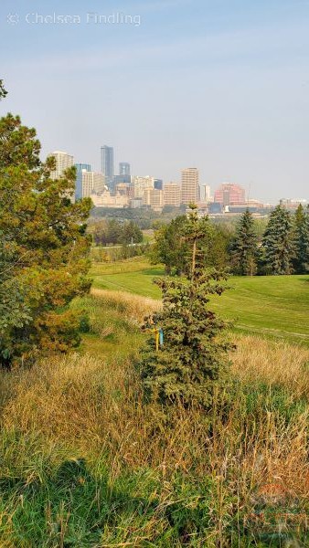
Near the Kâhasinîskâk Pedestrian Bridge, if you look back, you’ll see an awesome skyline of the city.
Mill Creek Ravine North
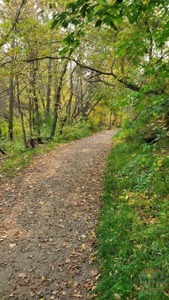
Once you reach Mill Creek Ravine North, the paved path directs you toward 82nd Ave. Depending on the volume of water, you might be able to hear the creek flowing in the ravine. There is typically lots of shade in this area due to the cluster of large trees but be preventative and apply sunscreen to avoid sunburn. Just before reaching 82nd Ave, you’ll walk right beside the Mill Creek Outdoor Swimming Pool. It’s an awesome place to go swimming in the summer when it’s hot.
Tip: There are many bikers on this stretch of pathway. Be aware of your surroundings and pay attention to the bells indicating that you should stick to the right side of the path.
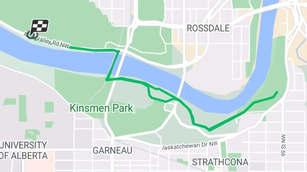
Kinsmen Park
Parking: Parking is available at Victoria Park. It isn’t a huge parking lot but typically it’s busier in the winter for skating season. It should have parking spots available for parking the rest of the year.
Walk towards the Dudley B. Menzies Bridge to make your way across the North Saskatchewan River and arrive at Kinsmen Park. This path will lead you to open fields with two smaller parking lots. You’ll eventually reach the Queen Elizabeth Outdoor Pool. As you walk further east, you’ll arrive at the massive parking lot and the Kinsmen building.
Continue walking on the south riverbank passing under the Walterdale Bridge to Nellie McClung Park. The complete trail length was 6.87 km. It’s a nice area to walk along the river.
MacKinnon Ravine Park
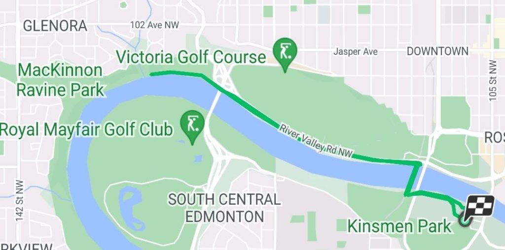
Parking: Park along Summit Drive NW, off of 149 Street, south of Stony Plain Road.
I forgot to start my tracker when we left from MacKinnon Park to Kinsmen Park on this particular day. When I went a different time from Kinsmen Park, I tracked it at 7.41 kilometres in length. It would be a few kilometres extra to start from MacKinnon Ravine Park. The map shows the direction we took going east. We crossed on the Dudley B. Menzies Bridge, to walk back west on the south riverbank. We crossed back on Groat Road Bridge (South of the Victoria Golf Course) to head back to MacKinnon Ravine Park to create a loop.
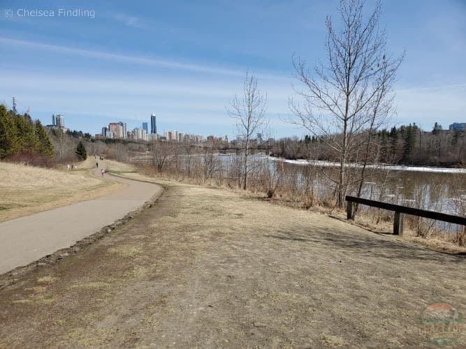
It’s an inviting walk east along the river. You’ll see downtown up above on the left-hand side.
Dudley B. Menzies Bridge
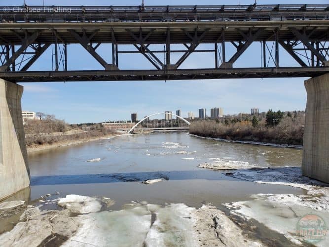
I took a picture from the Dudley B. Menzies Bridge. You can see the black High-Level Bridge with the lower white Walterdale Bridge in the background. We crossed the bridge to make a loop as I mentioned earlier.
River Valley Walterdale
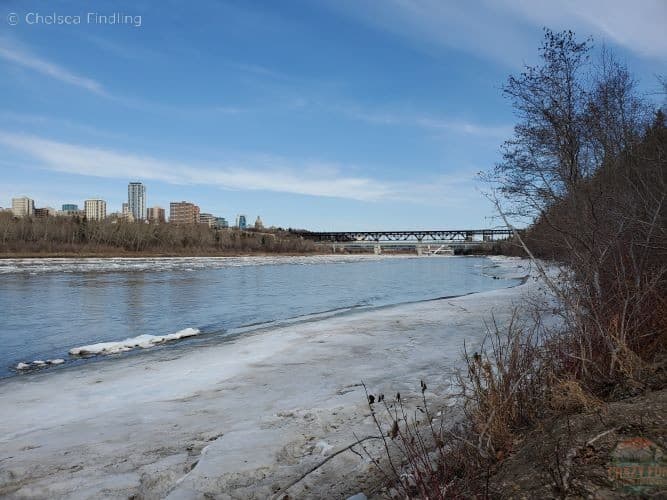
The south bank offers a different view of the river. This trail has a gravel base and can sometimes have snow in the early spring. Keep in mind you could get wet and muddy when walking these River Valley trails in Edmonton. We reached the Groat Road Bridge and continued back on the north riverbank to return to MacKinnon Park.
Hawrelak Park Footbridge/Buena Vista
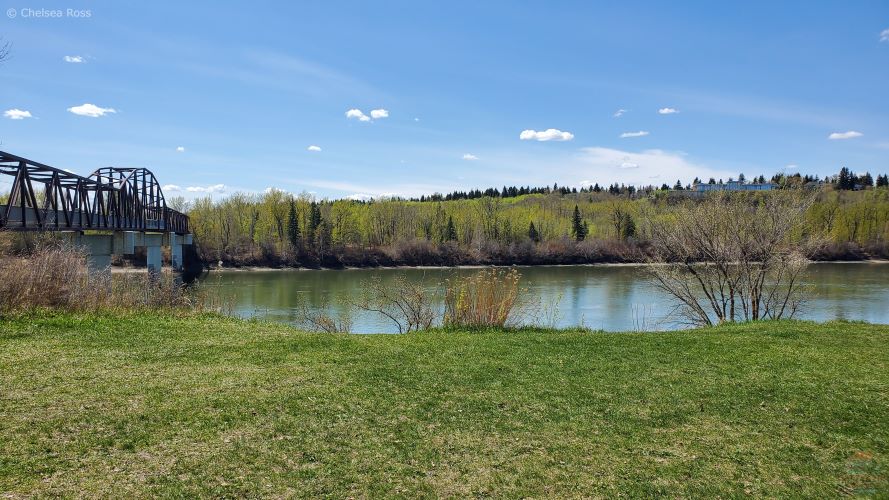
Parking: We parked at Laurier Park. They have multiple small parking lots around the park for you to leave your vehicle.
Featured in the above picture is the Buena Vista/Hawrelak Park Footbridge we crossed on our way to Hawrelak Park (currently closed for renovations). It’s a gorgeous park offering places to picnic, walk around and fly a kite on a windy day. It also offers a big pond for skating in the winter.
Sir Wilfrid Laurier Park
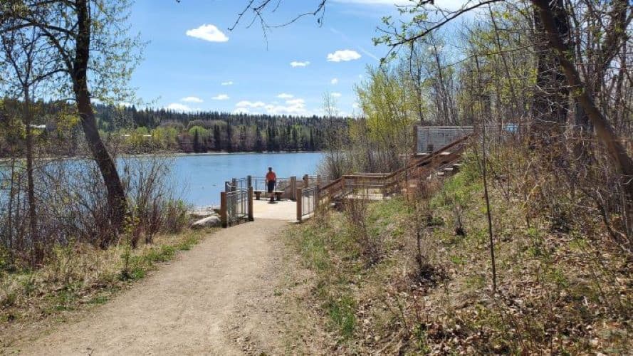
This view presents walking back towards Sir Wilfrid Laurier Park on a gravel path. It isn’t super wide so be aware of people passing via bikes or walking. It’s a beautiful area to walk with your partner.
Buena Vista/Whitemud Park
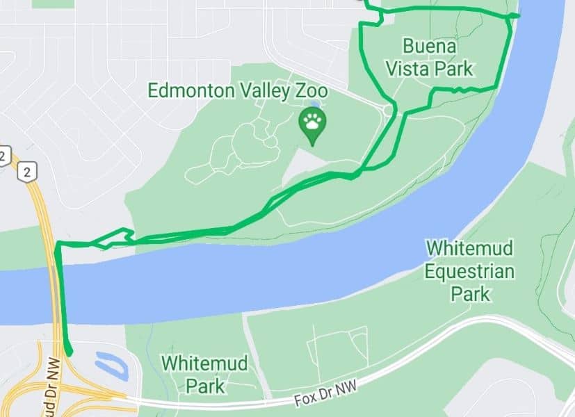
Parking: Park on the street in Buena Vista. The river valley trails in Edmonton in this area connect east and west forming a variety of loop options. The trail we took was 5.49 km long.
Start at Buena Vista to head towards Laurier Park, past the Edmonton Valley Zoo, on the Quesnell Bridge towards Whitemud Park and back.
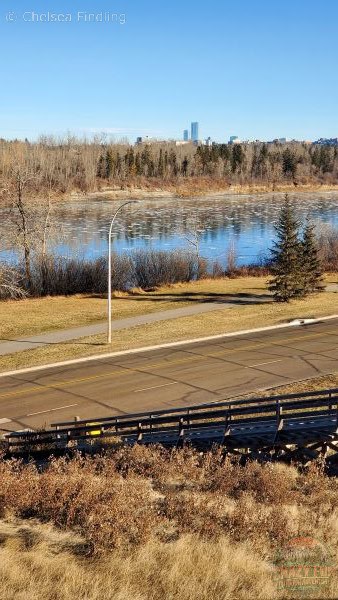
This picture was taken right in front of the the Talus Dome Balls near the Quesnell Bridge. It’s a short hike but nice to get outside for some exercise. You can choose to go longer if you prefer.
Whitemud Park South
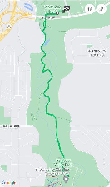
Parking: Park in Whitemud Park, just past Campbell Bridge. It offers one immediate parking lot, followed by a second parking lot closer to Campbell Bridge and a third place to park your vehicle a bit further along the ravine.
This trail was 6.37 kilometres long.
Walk south from Whitemud Park towards Snow Valley Park. It’s a nice gravel path in the trees that offers many different bird sightings. The views aren’t as gorgeous as walking along the river but there are creeks and nature to admire. It tends to be busy on the weekends so you’ll have many opportunities to say hi to your fellow hikers.
Blackburn Creek
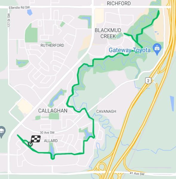
Parking: Park on the street in the Allard neighbourhood.
The trail in green was 14 kilometres long.
If you continued to walk down Whitemud South, you would eventually reach Blackburn Creek.
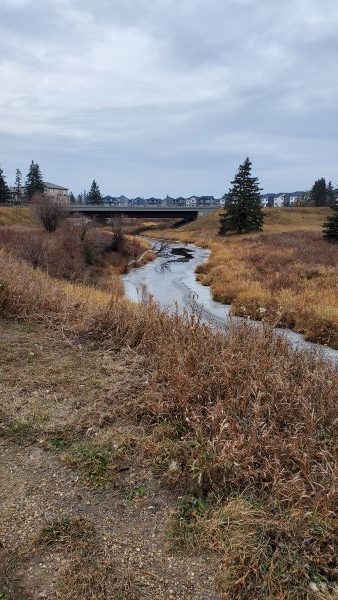
The trail initially starts on a pathway between houses and eventually meanders along the creek behind houses.
This is looking towards the 30 Ave SW bridge. It’s a pleasant paved trail walking along the creek the entire way to reach Ellerslie Road SW. It isn’t typically a busy path making it a relaxing area to walk for a couple of hours.
Fort Edmonton
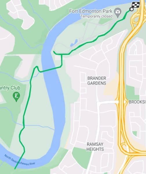
Parking: Park in Fort Edmonton Park.
This trail from Fort Edmonton Park towards Terwillegar was 8.57 km long.
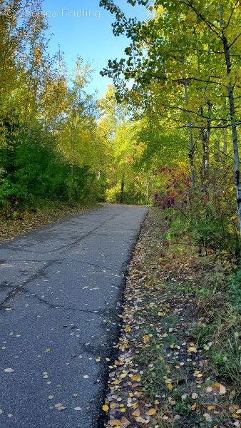
River valley trails in this part of Edmonton are paved. The main trail starts as a narrow path in the trees and opens up once you cross the Fort Edmonton Footbridge.
Fort Edmonton Footbridge
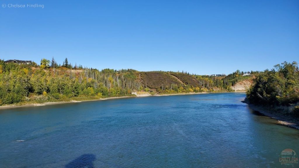
This bridge is nice and wide allowing many walkers to walk on both sides of the path. There are a couple of lookouts to take gorgeous scenery pictures on each side of the bridge.
Terwillegar
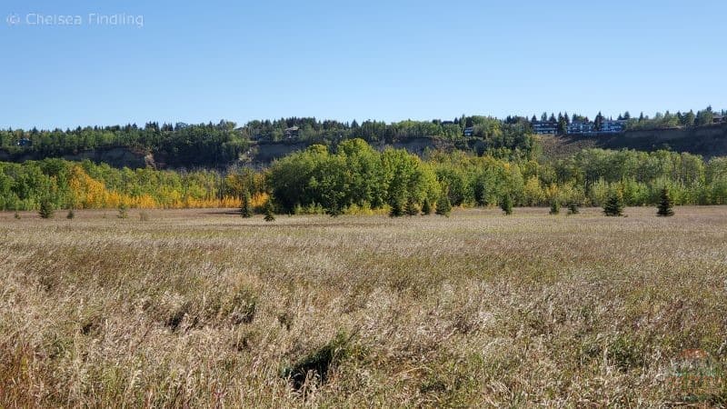
Once you head closer to Terwillegar Park, you’ll hike through a wide-open field. The trail narrows the closer you get to the parking lot.
Mill Creek Ravine South
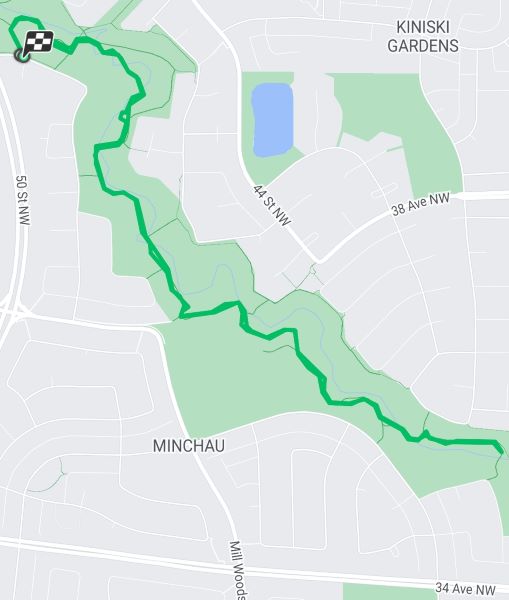
Parking: Park on the street along 47 Street NW.
The walking path’s starting location is kitty-corner to 50th Street and 40th Ave and continues towards 34th Street NW. We hiked 5.08 km on this one.
Mill Creek Ravine South is in its own area in Mill Woods but is a fantastic place to go walking in Edmonton.
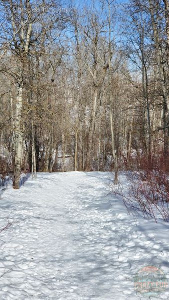
The trails are nice are wide enough allowing walkers on both sides of the trail to walk comfortably. Depending on the time of year you go, you might encounter snow.
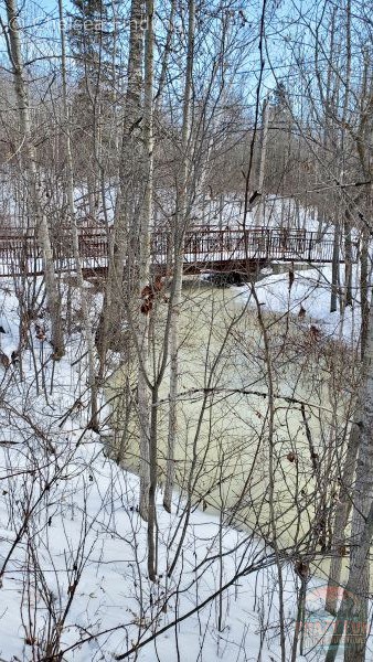
You’ll pass many bridges along the way. There aren’t spectacular open views but it’s nice to be in the middle of nature in the trees enjoying time outside.
Final Thoughts
Are you feeling excited to explore some of the River Valley Trails in Edmonton? Where do you want to discover first? You might be interested in Rundle or Goldbar Park. Venturing in Whitemud Park South is always an awesome place to hear the birds chirping. Blackburn Creek is isolated from crowds of people offering a perfect place to go on an afternoon walk with your partner. If you want to discover Terwillegar, Fort Edmonton, MacKinnon or Kinsmen Park, they are all spectacular places to walk along the river on a sunny day. Consider combining some sections of the suggested walks for a longer adventure. It’s time to go get some exercise and fill your lungs with fresh air. Get excited to share time outdoors with your partner!

Leave a Reply